How to use Google Maps as a motorhome route planner
Planning and navigating a long-distance caravan or motorhome journey may seem daunting, but learning how to get the best out of a motorhome route planner can transform the experience.
Many applications are available, including in-car sat-nav and retro-fitted units from companies like Garmin and Tom Tom.
However, Google Maps remains one of the most popular, powerful and flexible choices for caravanners and motorhome owners.
Google Maps is the default installation on Android devices. The application can also be downloaded for free on iPhone from the App Store.
Moreover, Google Maps is native to the Google Chrome web browser, making planning your journey on a laptop or computer a breeze.
This article explains how to use Google Maps to get the best results. We’ve also added a use case based on a caravan journey from Bournemouth on the South Coast to the Lake District’s Wallace Lane Farm camping site.
Before we get started, there are two key things to remember:
- Not all roads are suitable for caravans or large motorhomes
- Google Maps uses national speed limits to calculate arrival times
The good news is that you can choose your preferred route to avoid single-lane carriageways. You can also cater for extra time needed to travel at 60mph or less on dual carriageways and motorways.
Getting started
Open Google Maps in a Google Chrome browser. You can also plan a route on a mobile device, but it’s more straightforward initially on a desktop.
Type a destination into the search bar, then select Directions. You can also launch Maps from any website with a Maps link on their contact page or from some Google search results.
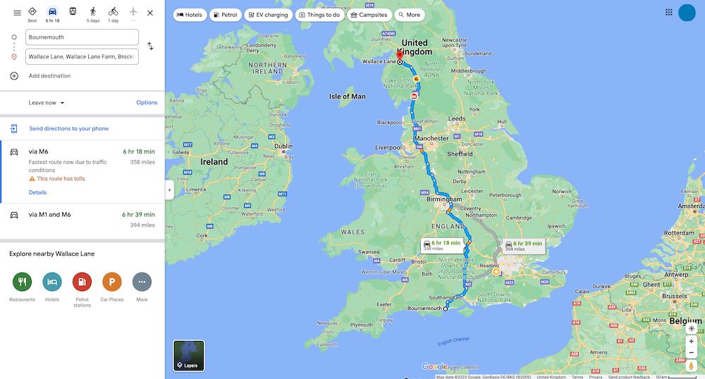
Select the car icon and enter the starting point address. Google displays a map with the fastest route in blue and alternative routes in grey.
Route options
There are three ways to customise your route:
- Select an alternative route
- Use the route options checkboxes
- Create waypoints
1. Alternative routes
Alternative routes are helpful if you need to travel via a location that isn’t on the primary route. In our case, we may need to travel via Luton to collect a family member from the airport. Click on a grey route to change an alternative route to the primary route.
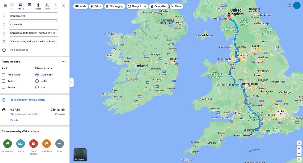
2. Route options
Open Route options below the destination address and avoid motorways, tolls or ferries if preferred. Once you make a selection, Google Maps automatically updates the blue route.
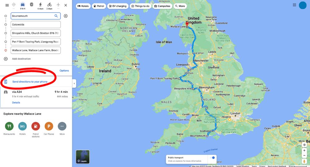
3. Create waypoints
We can also choose a personalised route by adding waypoints or stops.
For example, let’s say we’d like to avoid the motorways around Birmingham. We could add waypoints in the Cotswolds and the Shropshire Hills to create a scenic route.
To create an alternative route manually, click ‘Add destination’ and enter the address. You can add as many destinations as you like. You can also zoom into the map to identify specific areas of interest. Then, drag the new address fields in order so your start point is first and the final destination is last in the list. Google will now update the map to show the new route.
Adding a campsite to your motorhome route planner
If you’d rather stay overnight at a campsite on the way to your final destination, click the Campsites icon at the top of the screen. Google will drop campsite pins on the map and show results on the left-hand side.
If you’d like to add a campsite as a waypoint, click the pin to bring up the campsite details and select Add stop.

Using maps on the go
You’ve added a Touring Park stop, and your route is complete. All that remains now is to ‘Send directions to your phone’. Google will send the route by email to your mobile phone. Click on the link in the email to start your journey using the Google Maps app.